NDC Detour Map - Phase 2An aerial map with a dotted line going around a large field that has a residential area on the northeast side. There is a solid black line on the west side labled Phase two. No streets are labeled.https://www.cabq.gov/parksandrecreation/images/ndcdetourmapphase2maponly.png/viewhttps://www.cabq.gov/parksandrecreation/images/ndcdetourmapphase2maponly.png/@@images/image-1200-cb85ed0b7a2eaf6fd78a5e7d8dc3bd00.jpegNDC Detour Map - Phase 2An aerial map with a dotted line going around a large field that has a residential area on the northeast side. There is a solid black line on the west side labled Phase two. No streets are labeled.https://www.cabq.gov/parksandrecreation/images/ndcdetourmapphase2maponly.png/viewhttps://www.cabq.gov/++resource++plone-logo.svg
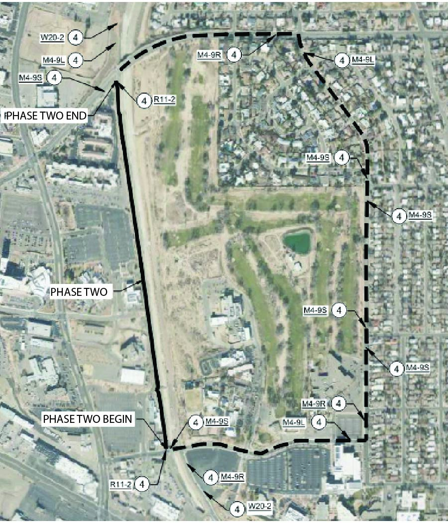
NDC Detour Map - Phase 2
An aerial map with a dotted line going around a large field that has a residential area on the northeast side. There is a solid black line on the west side labled Phase two. No streets are labeled.