Albuquerque APINH Visibility MeshA map of Albuquerque showing over 230 APINH businesses distributed citywide. The map highlights a high concentration of businesses in the Northeast Heights, a transit-connected cluster along the Central ART line, and the proximity of businesses to red-shaded environmental risk zones in the International District and North I-25 areas.https://www.cabq.gov/office-of-equity-inclusion/images/apinh-visualization-mesh.png/viewhttps://www.cabq.gov/office-of-equity-inclusion/images/apinh-visualization-mesh.png/@@images/image-1200-751991bd16d7192762b0d093c77f0133.pngAlbuquerque APINH Visibility MeshA map of Albuquerque showing over 230 APINH businesses distributed citywide. The map highlights a high concentration of businesses in the Northeast Heights, a transit-connected cluster along the Central ART line, and the proximity of businesses to red-shaded environmental risk zones in the International District and North I-25 areas.https://www.cabq.gov/office-of-equity-inclusion/images/apinh-visualization-mesh.png/viewhttps://www.cabq.gov/++resource++plone-logo.svg
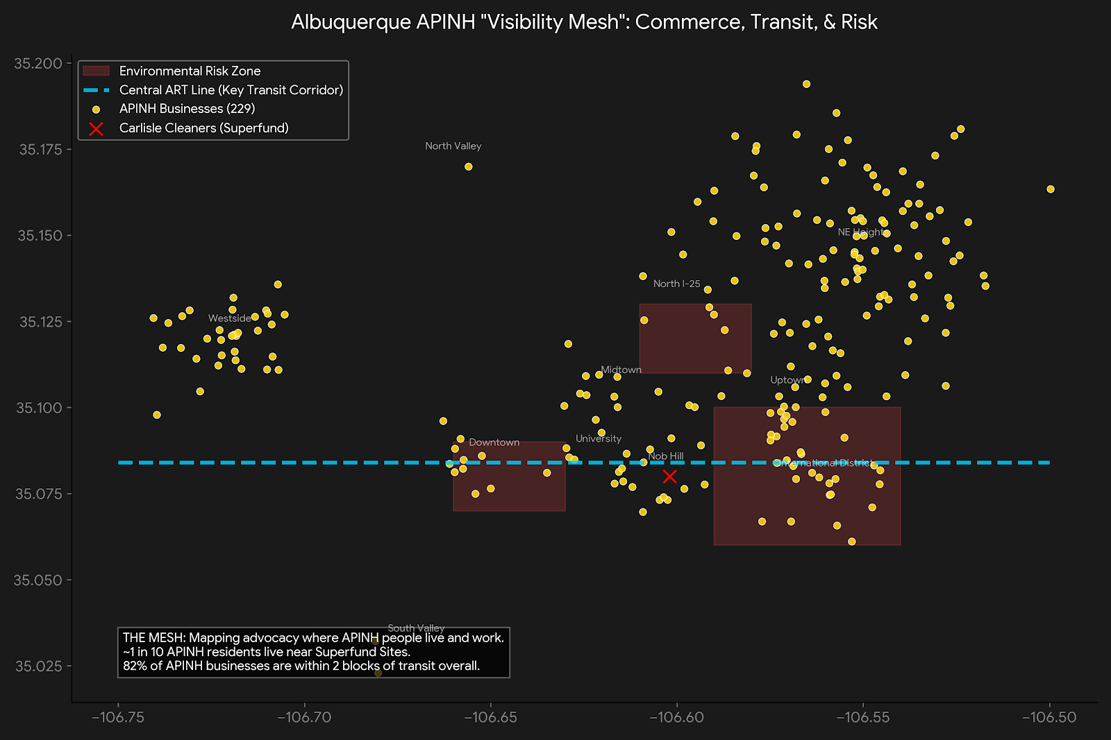
Albuquerque APINH Visibility Mesh
A map of Albuquerque showing over 230 APINH businesses distributed citywide. The map highlights a high concentration of businesses in the Northeast Heights, a transit-connected cluster along the Central ART line, and the proximity of businesses to red-shaded environmental risk zones in the International District and North I-25 areas.